- Home
- Our Neighborhood
- Recreation Trails in Lower Falls
Recreation Trails Overview
Lower Falls is lucky to have access to miles of walking trails
A brief history
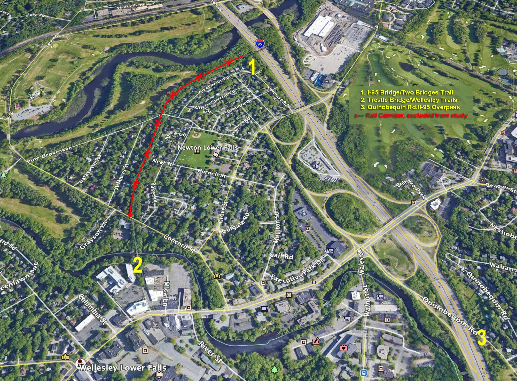
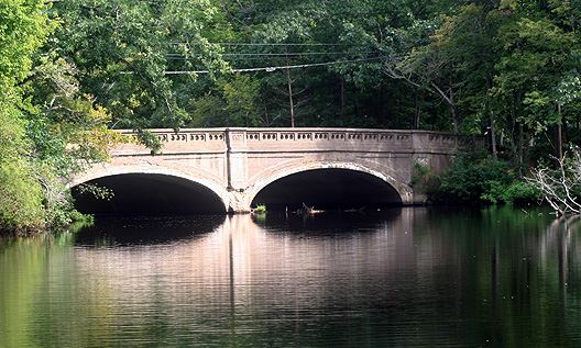
- Across the "Trestle" Bridge" from Concord St are 46 miles of trails in Wellesley
- The Newton Conservators maintains a list of trails in Newton
- The Town of Weston has over 100 miles of trails.
- The Riverside Greenway is a trail system in development - a combination of shared-use, ADA-compliant and foot-trails to connect the current terminus of the Blue Heron Trail in Lyon's Field in Auburndale with the Lower Falls "Trestle" Bridge". The Riverside Greenway Working Group presented their work over the last year to make this vision reality to an enthusiastic, standing-room-only audience at the Newton Main Library on January 24th 2018.
- View the slide show or a video of the event at the Newton Public Library in January 2019 with presentations by Emily Norton of the CWRA, Dan Driscoll of Mass DCR and Herb Nolan from the Solomon Foundation
- The Pony Truss Trail can be reached across the Two Bridges Trail from DeForest St, and provides a beautiful walk along the Charles River.
The concept of a shared use (bike/footpath) through Newton Lower Falls has been discussed since the 1970's. In 2009, the Massachusetts Department of Conservation and Recreation proposed using the abandoned rail right-of-way for a shared-use trail. In response, the LFIA formed a group to evaluate alternative trail options and since then has acted as an educational resource for the community. The LFIA website will serve as a source of news on trail related activities involving Lower Falls.
DCR Feasibility Studies:
Lower Falls Shared-use Trail
• Conduct a feasibility study for a shared-use trail connection between the Route I-95 rail bridge at the southeast corner of Leo J. Martin Golf Course and Wellesley, and the south side of the I-95 Overpass on Quinobequin Road, Newton, MA.
Quinobequin Road to Leo J. Martin Golf Course Newton and Wellesley
- The project aims to address existing safety, mobility and accessibility concerns along Quinobequin Road, while also making sustainable and long-lasting improvements to stormwater management and riverine ecology.
The consultant team shall inventory DCR-owned parklands, other open space and roadway right of ways to propose alternative layouts for safe and accessible bicycle and pedestrian accommodations.
The LFIA will assemble a committee to evaluate alternatives and interface with the DCR Design team to represent the Lower Falls community.
View the slide show and recording of the March 19th, 2020 Lower Falls Trails Update that discusses this study and other trails developments associated with the Riverside Development and the Riverside Greenway in Aburndale.
To view the project documents visit the DCR websites for Lower Trails Trails and the Quinobequin Trail 100% Design studies.
In 2009 the LFIA's Alternative Trails Group assessed routes as alternatives to the rail trail, download that study to see options the DCR may have consider.